Central and South Stormwater Management System and Rear Yard Conditions Overview
Click for here for the Original PDF. If the below content should conflict with the content of the linked PDF, then the content of the PDF supersedes.
Public Information Meeting Recording (on YouTube)
Original use: The attached PDF presentation was originally created for a public information meeting held on May 16, 2023 by Barraco and Associates District Engineering to answer residents’ questions about the Moody River Estates Central and South stormwater management system, rear yard conditions, and recent letters that were mailed to residents.
Moody River Estates CDD: Central and South Stormwater Management System and Rear Yard Conditions Overview
May 16, 2023
Barraco and Associates District Engineering
Storm Water Management Systems of SWFL
- South Florida Water Management District regulates this resource (surface water and groundwater).
- Minimum road elevations 5-year, 1-day storm event stage (5.6″ over 24 hours)
- Minimum perimeter berm elevations 25-year, 3-day storm event stage (11.3″ over 72 hours)
- Minimum finished floor elevations 100-year, 3-day storm event stage (14.3″ over 72 hours)
- Basins required to recover from a storm event within 12 days following completion of storm event.
- Basin control elevations are established based on wet season water table in order to support wetlands and recharge groundwater.
- Allowable discharge rates and directions of flow are based on historic conditions of the basin.
- Storm water is contained within basins up to perimeter berm elevation and discharged through a control structure above control elevation at the allowable discharge rate.
- The volume provided above control elevation in a lake is considered storage and considered in modeling storm water management systems.
- Roadways provide a volume of storage in certain storm events.

Stormwater Management System Boundary Conditions
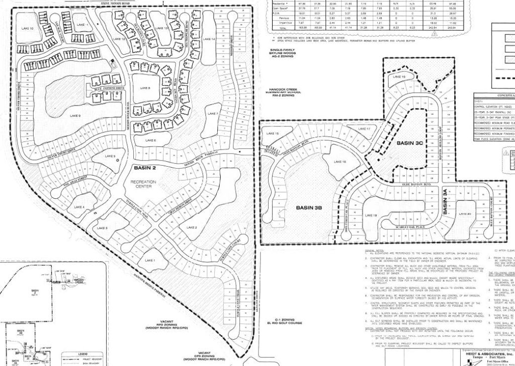
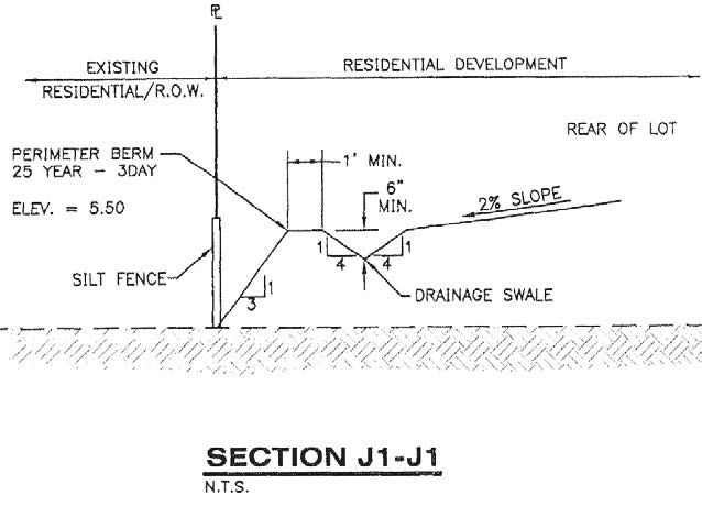
- Perimeter berm requirements: SWMS basins are required to detain at minimum the 25 year storm runoff volume. ie. exterior perimeter berms of a basin or overall development.
- The relationship between stormwater runoff volume and storage of the basin establishes the minimum elevation of the perimeter berm.
- In order to contain runoff within the berm a swale is typically established inside of the berm to capture runoff and covey to the nearest stormwater facility, typically to a lake or detention area via an inlet and pipe system.
- Swales may also be established to contain water for water quality treatment purposes before overtopping the berm to another area within the basin. ie. runoff from yards is captured in a swale for treatment prior to overflowing into an onsite preserve area.
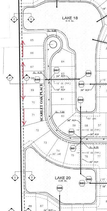
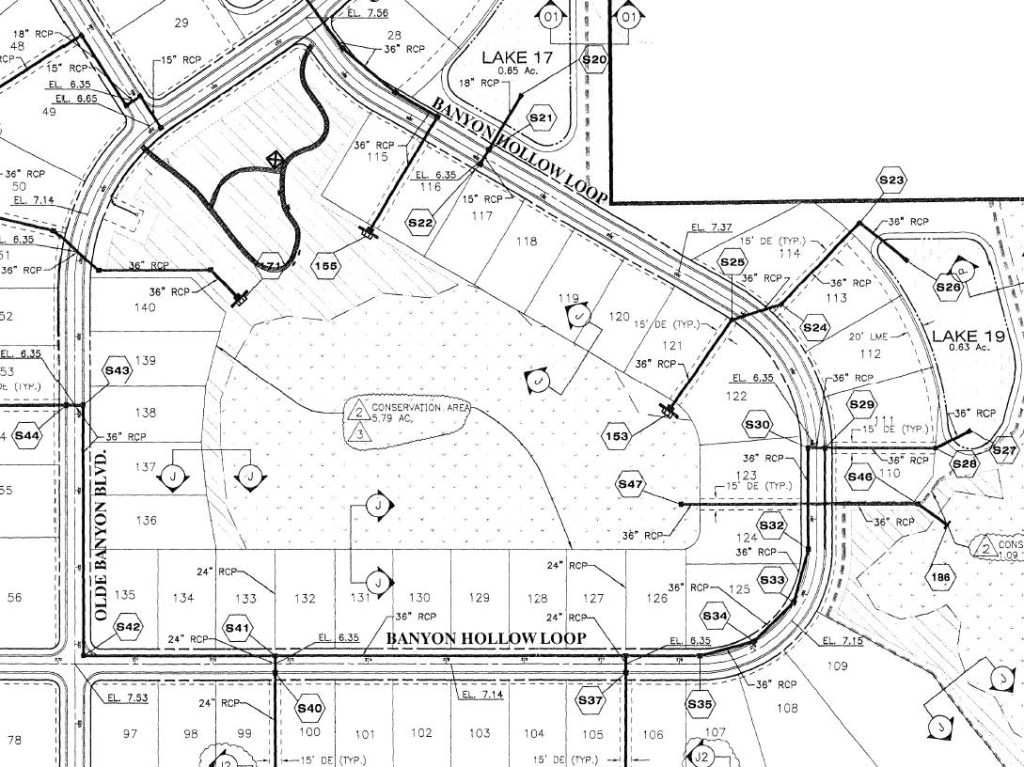
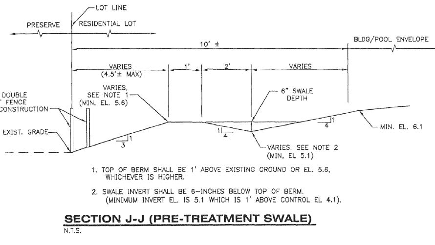
Common Berm and Swale Issues
- Swales filled and/or berms cut down as part of final lot grading
- Homebuilding, patio expansions, pool construction.
- Swales become filled and/or berms impacted due to natural causes
- Soil migration from higher areas in lot to swale due to rainfall and runoff
- Swales become filled and/or berms impacted due to other causes
- Landscape maintenance (ie. lawn mowing)
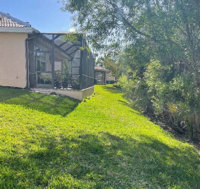
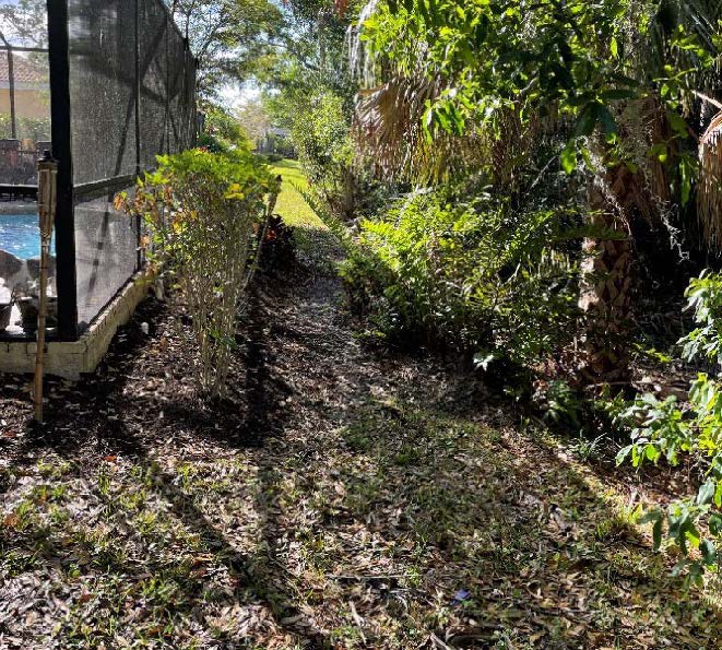
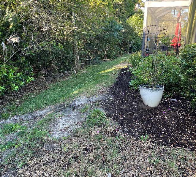
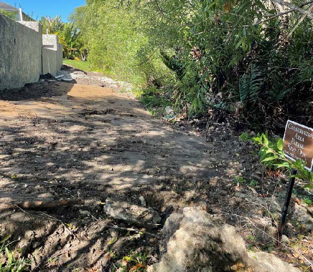
Berm and Swale Remediation
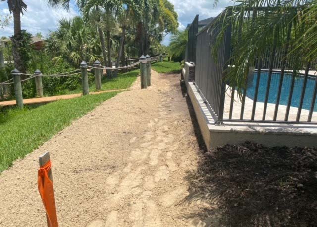
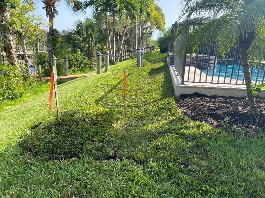
- Swales filled and/or berms cut down as part of final lot grading from homebuilding, patio extensions, or pool construction: Regrade swale and re-establish minimum berm elevation to accommodate reduced area due to homeowner improvements.
- Swales become filled and/or berms impacted due to natural or other causes: Regrade swale by removing material from swale area and use excess to re-establish minimum berm elevation.
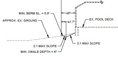
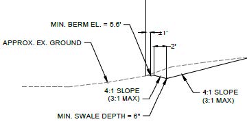
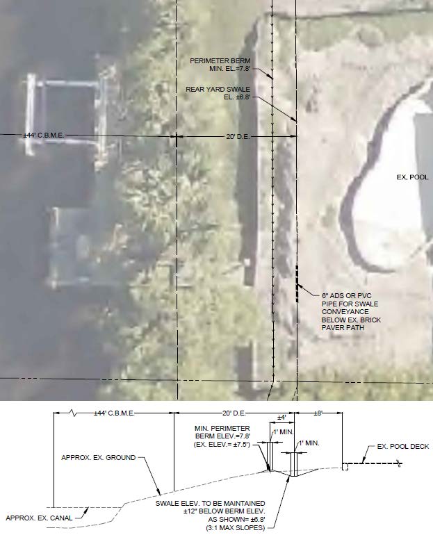
Recommended Remediation Process
- Property owner to contact engineer of their choice to confirm deficiencies and prepare a remediation plan. Barraco and Associates serves the Moody River Estates Community Development District as District Engineer. CDD Board has directed our firm to provide an initial consultation/site meeting.
- Note: a remediation plan may not be required for standard maintenance based on existing permitted section (ie cleaning out swale and re-establishing berm).
- If remediation plan is required due to unique lot conditions (ie extended patio or pool deck) it must be reviewed by the District Engineer and the Moody River Estates HOA ARC for approvals.
- Contractor performs the work. Survey stakeout of minimum berm elevation and/or swale grade may be required by contractor.
- Prior to sodding the remediation area, we recommend reaching out to the District Engineer to confirm the remediation is consistent with the intent of the applicable permits and remediation plan.
- After final stabilization of remediation area District Engineer will confirm work is complete in accordance with the intent of the applicable permits.
Questions?
Please contact the District Engineer. Contact information can be found on the contact page.